Motoatlas Romania je určen především pro motorkáře. Jsou v něm totiž vyznačeny trasy zajímavé pro motorkáře jak na silnici, tak i v terénu, navíc je částečně voděodolný. Atlas je vyroben na oboustranně laminovaném papíře, takže odolává dešti... Zobraziť viac
Trojjazyčná publikace (česky, anglicky, německy) - Chladné zbraně z období Habsburské monarchie - představuje v současné... Zobraziť viac
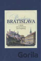
Žiadate ma, aby som vám porozprával rozprávku. Načo ? Veď vaše mesto je rozprávka. Hans Christian Andersen počas návštevy... Bratislava - Pressburg a okolie je reprezentačná obrazová publikácia opisujúca v krátkych textoch a pomo Zobraziť viac
Historický atlas obyvatelstva českých zemí je jedním z prvních děl hodnotících prostorové aspekty téměř stoletého vývoje obyvatelstva na dnešním území Česka. V celkem dvanácti kapitolách jsou ve vývojovém srovnání představena... Zobraziť viac
Žiadate ma, aby som vám porozprával rozprávku. Načo ? Veď vaše mesto je rozprávka. Hans Christian Andersen počas návštevy Bratislavy Bratislava - Pressburg a okolie je reprezentačná obrazová publikácia opisujúca v krátkych textoch... Zobraziť viac
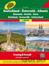
Okrem prehľadného usporiadania majú cestné mapy aj množstvo ďalších informácií. Cestné podmienky, pamiatky, kempingy a rôzne vnútorné plány mesta. Extra veľké písmo, turistické informácie, mestský register s PSČ, mapy miest, adresár ulíc. 29 plánov Zobraziť viac
The Phantom Atlas is an atlas of the world not as it ever existed, but as it was thought to be. These marvellous and mysterious phantoms - non-existent islands, invented mountain ranges, mythical civilisations and other fictitious geography... Zobraziť viac
If you were to peel back the Earth's surface like an orange, then take a sly peek underneath, what extraordinary things would you see? ... Zobraziť viac
Obsahuje přehledné mapy celého území Itálie včetně Sicílie a Sardinie v měřítku 1 : 200 000 , s praktickým značením, množstvím průjezdních plánů italských měst, praktickými turistickými informacemi, tabulkou vzdáleností a bohatým... Zobraziť viac
Meyers Neuer Weltatlas zeichnet in bewährter digitaler Präzision ein aktuelles Bild unserer Erde.. Zobraziť viac
Ein Atlas der Superlative mit völlig neuem Atlaskonzept: mit großem Sonderteil zum Zeitalter der großen Entdeckungen. Die digital erstellten Karten zeichnen ein umfassendes Bild unseres Planeten... Zobraziť viac
National Geographic's flagship Atlas of the World, now in its 11th edition, provides authoritative maps of every country, ocean, and region of the world, as well as thematic maps and accompanying graphics showing important population, environmental... Zobraziť viac
A stunning companion to the bestseller Our World, this extraordinary book is a beautiful and accessible introduction to the world's seasons, which, after reading, transforms into a 3D globe... Zobraziť viac
The Atlas of Geographical Curiosities - a glorious celebration of an unusual world... Zobraziť viac
From the defining boundaries of the Balkan states to the icy terrain of Antarctica, over 640 maps created with the latest digital mapping techniques and satellite data are combined in Concise World Atlas to bring you Earth in more detail ... Zobraziť viac
This is our planet, as you have never seen it before. From the terrifying snakes pursuing a newly hatched iguana to the sloth swimming in search of a mate, Planet Earth II brought unforgettable moments and a unique insight into the natural world... Zobraziť viac
Explore the world with this lavish book of maps. This collection of 52 highly illustrated maps details not only geographical features and political borders, but also places of interest, iconic personalities, native animals and plants, local peoples,... Zobraziť viac
Německá edice české publikace Atlas zemí Koruny české. Atlas mimo jiné obsahuje přehledné mapy Čech, Moravy, a Slezska (Klaudyán, Aretin, Criginger, atd.), mapy regionů (Kladska, Chebska, Loketska, českých a moravských krajů), plány měst... Zobraziť viac