Díky podrobné digitální kartografii a přesným měřítkům jsou turistické mapy freytag & berndt ideálními společníky pro pěší turistiku a cykloturistiku. Jsou pravidelně revidovány a obsahují aktualizované informace o turistických stez Zobraziť viac
Umgebungskarte - Durchfahrtsplan - Flughafen - Innenstadt - Straβenverzeichnis... Zobraziť viac
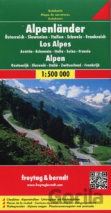
Austria, Slovenia, Italy, Switzerland, France... Zobraziť viac
Lonely Planet’s Austria is our most comprehensive guide that extensively covers all the country has to offer, with recommendations for both popular and lesser-known experiences... Zobraziť viac
A cornucopia of culture, Vienna puts art, music and theatre at centre stage... Zobraziť viac
Allegra Publications: This 160-page, soft cover, full-colour guide features detailed profiles of Vienna's best coffee... Zobraziť viac
Wander-, Rad- und Freizeitkarte bietet: GPS-tauglich; Freizeitführer; Ortsregister; ... Zobraziť viac
Atlas Rakouska v měřítku 1:150 000. Atlas obsahuje veškeré nezbytné informace potřebné k cestování po celém Rakousku. Zobraziť viac
Vienna may be famous for its monumental palaces and classical music scene, but Austria's capital isn't all about the past - expect contemporary art galleries, cool cafés and buzzing bars galore... Zobraziť viac
Automapa obsahuje: Plány miest; Register miest s PSČ; Vhodná pre GPS; ... Zobraziť viac
Mapa v mierke 1:25.000 s aktívnym sprievodcom a GPS... Zobraziť viac
- Touristische Informationen; - Innenstadtplan; - Straßenverzeichnis; ... Zobraziť viac
Tourist information City map Zobraziť viac
Lonely Planet's Pocket Vienna is your guide to the city's best experiences and local life - neighbourhood by neighbourhood... Zobraziť viac
A cornucopia of culture, Vienna puts art, music and theatre at centre stage. Whether you want to explore the stunning Schönbrunn Palace and Gardens, indulge in a slice of sachertorte at one of the city's grand cafés ... Zobraziť viac
S mapami Marco Polo sa ľahko zorientujete doma aj v zahraničí, pretože sú dobre čitateľné a optimálne prispôsobené danej krajine... Zobraziť viac
Automapa v měřítku 1 : 300 000 (1 cm = 3 kilometry) zobrazuje kompletní síť silnic a dálnic s dopravními vzdálenostmi, dále... Zobraziť viac
Gingko Press: CitiX60 are guides to some of the worlds most renowned design hubs curated by a select group of creative... Zobraziť viac